PIROI-French Red Cross and its partner, the Comoros Red Crescent, asked the consulting company Ramboll to analyse the feasibility of developing community-based early warning systems (CBEWS) in the Union of the Comoros. The analysis looked at how early warning systems for cyclones and flooding work at community level.
It analysed social and geographical inequalities in terms of disaster risks, as well as the knowledge, attitudes, and different practices within communities. The issues faced by forecasting services and disaster risk management organisations were also studied, as local stakeholders are partly dependent on institutional capacities for early warning and action.
-
Natural hazards in the Union of the Comoros

Photo credit: Louis WITTER
Battered by 150 km/h winds, these houses did not stand a chance | Moroni, Grande-Comore, Comoros, Thursday 25 April 2019.

Photo credit: Comores Infos
Fomboni dyke in the Comoros gave way under the force of Cyclone Kenneth.
Disasters related to extreme weather events impact socially and economically vulnerable communities disproportionately, and this situation is exacerbated on islands exposed to low-pressure systems, flooding, rising sea levels and prolonged drought.
According to the 2011 IPCC report, roughly 600 million people worldwide live in coastal low-lying areas prone to flooding due to sea-level rise. The Union of the Comoros is a small island developing state (SIDS) where these risks are particularly worrying. In April 2019, for example, Cyclone Kenneth devastated the country, destroying thousands of homes and affecting 345,000 people.
Early Warning, Early Action (EWEA) capabilities are key to Comoros’ emergency preparedness and response system, but there are still shortcomings, despite efforts by forecasting and disaster risk management agencies. This is one of the findings of a new PIROI study on the feasibility of developing community-based early warning systems (CBEWS) in the Union of the Comoros.
A community-based early warning system is an infrastructure and process designed to swiftly and effectively detect, assess, and communicate imminent threats posed by dangerous or catastrophic events such as storms, flooding, earthquakes or volcanic eruptions.
A CBEWS aims to mitigate human and material losses by providing early warning to relevant communities, local authorities and humanitarian organisations so that they can take the necessary precautions or evacuate if needed.
These systems combine meteorological data, sensors, communication networks and warning dissemination tools to ensure that they are as efficient as possible in reducing natural disaster-related risks.
-
The early warning system in the Union of the Comoros
Early warnings for cyclones at regional, municipal, and community level are inadequate. In terms of flooding, for instance, there is a lack of hydrological models, as well as monitoring equipment and capacity, particularly on the islands of Anjouan and Mohéli.
Since 2011, the Comoros has seen significant changes to its national disaster risk management system, in particular with the devolution of civil registration responsibilities to municipalities. This has strengthened the role of community-based organisations in developing the National Disaster Risk Reduction Strategy (SNRRC 2014-2019) and its plan of action, which includes major priorities such as community capacity building, promoting community resilience, and enhancing knowledge and information systems. The potential of community-based stakeholders to forecast risks should also be acknowledged, and national plans should be more regionally focused in order to better address smaller-scale local risks.
Read the full report here.

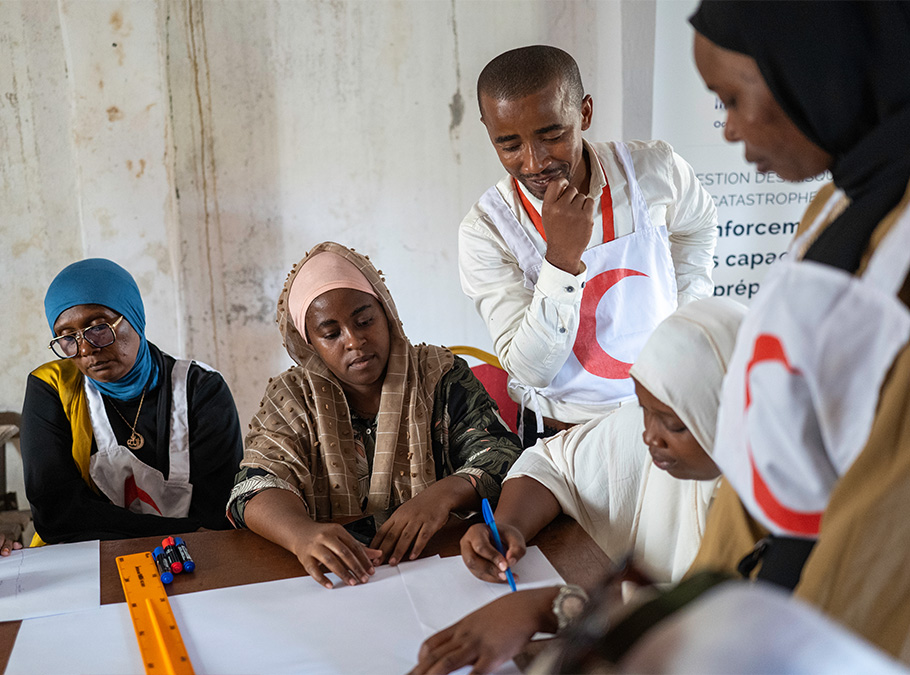
Photo credit: Marion Joly | Comoros Red Crescent
The communities surveyed on all three islands have limited awareness of natural hazards, with only around 7 out of 10 people able to name at least one cyclone warning factor (compared to 8 out of 10 for flooding). As a result, the community is not very vigilant.
- A cyclone-specific CBEWS could be developed through various measures at both national and local levels, building on the ongoing revision of the SNRRC, the PNC, and the Disaster Risk Management Bill currently being drafted.
- Two solutions have been put forward and detailed in the report, consisting of improving flood forecasting capacity to enable the flood-specific CBEWS to work:
- Developing monitoring methods based on participatory observation of ‘low-cost low tech’ tools – so called because they need little technological input (installing and monitoring of limnometric water level gauges in the side channels of perennial/seasonal rivers)
- Analysing priority catchment areas (hydrological modelling) and installing hydro-meteorological micro-stations.
Reactivating the so-called “local” committees is also recommended, as well as the Regional Civil Protection Departments, as provided for in the National Contingency Plan (NCP).